

North Central Texas Plant List from Native Landscape Certification Program
https://www.dropbox.com/s/mtianpd6frl36gj/NPSOT%20North%20Central%20TX%20List%2020.0719%20fixed.pdf
About the Cross Timbers EcoRegion
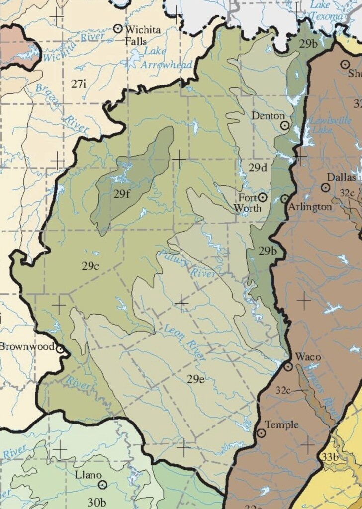
Level IV Ecoregions in the Cross Timbers Area
- 27i – Broken Red Plains
- 29b – Eastern Cross Timbers
- 29c – Western Cross Timbers
- 29d – Grand Prairie
- 29e – Limestone Cut Plains
- 29f – Carbonate Cross Timbers
- 30a – Edwards Plateau
- 30b – Llano Uplift
- 32a – Northern Blackland Prairie
- 32c – Flood Plains and Low Terraces
The Plant List for North Central Texas was developed by the Native Landscape Certification Program for use in their series of landscaping classes. To best use the list pay close attention to the “native region” column on the list. The abbreviations in this column are defined in the footnotes on each list and are correlated to the Level IV eco-regions shown on the map above. The list was created for use in classes for particular events and are not meant to be an exhaustive list of suitable plants for a location. If you are interested in plant lists for areas not shown on the map above see all the NLCP plant lists.
In the Cross Timbers you can find natives at the nurseries participating in our NICE! Native Plant Partners program. Wherever you shop ask to see native plants.
View our current Cross Timbers Plant List for Weatherford and the Parker County area. (All lists on this page open in a new window)
Not all non-natives are invasive but the plants on this list of non-native invasive plants are definitely not recommended.
This list of “Alter-Natives” will help you substitute native plants for non-natives in your garden while giving a similar look.
What is the Cross Timbers?
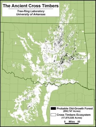
The Western Cross Timbers extend from far southern Oklahoma, including parts of Love and Carter counties, into central Texas, where it covers large parts of Montague, Young, Jack, Wise, Stephens, Palo Pinto, Parker, Eastland, Erath, Brown, San Saba, and Mills counties, as well as smaller parts of Clay, Cooke, Callahan, Hood, Coleman, and McCulloch counties. This area includes the towns of Weatherford and Mineral Wells; Stephenville lies on the eastern fringe, while Brownwood is on the western edge.
The part of this region north of I-20 is sometimes colloquially referred to as the Palo Pinto Mountains; the hills are isolated, rugged, and scenic, with spectacular bluffs along the Brazos River as it flows through the region. John Graves wrote about this area and its people in his classic book Goodbye to a River.
Coal mining has historically been an important activity, as bituminous coal deposits are found throughout the region. In the mid-to-late 19th century, Comanche Indians occupied this area, and it became a flash point for conflict between various groups of white settlers, the Comanche, and the U.S. Cavalry; Forts Belknap and Richardson were built in the area to protect this part of the frontier.
Richard Francaviglia has written an excellent introduction to the natural environment of the area called The Cast Iron Forest, so-named from a quote from Washington Irving who visited the area in the 1830’s and wrote that it was like traveling through “forests of cast iron.”
You can read more about the Cross Timbers and its vegetation at these sites: