

| Area | Map | NLCP PDF Plant List |
|---|---|---|
| Austin Area | 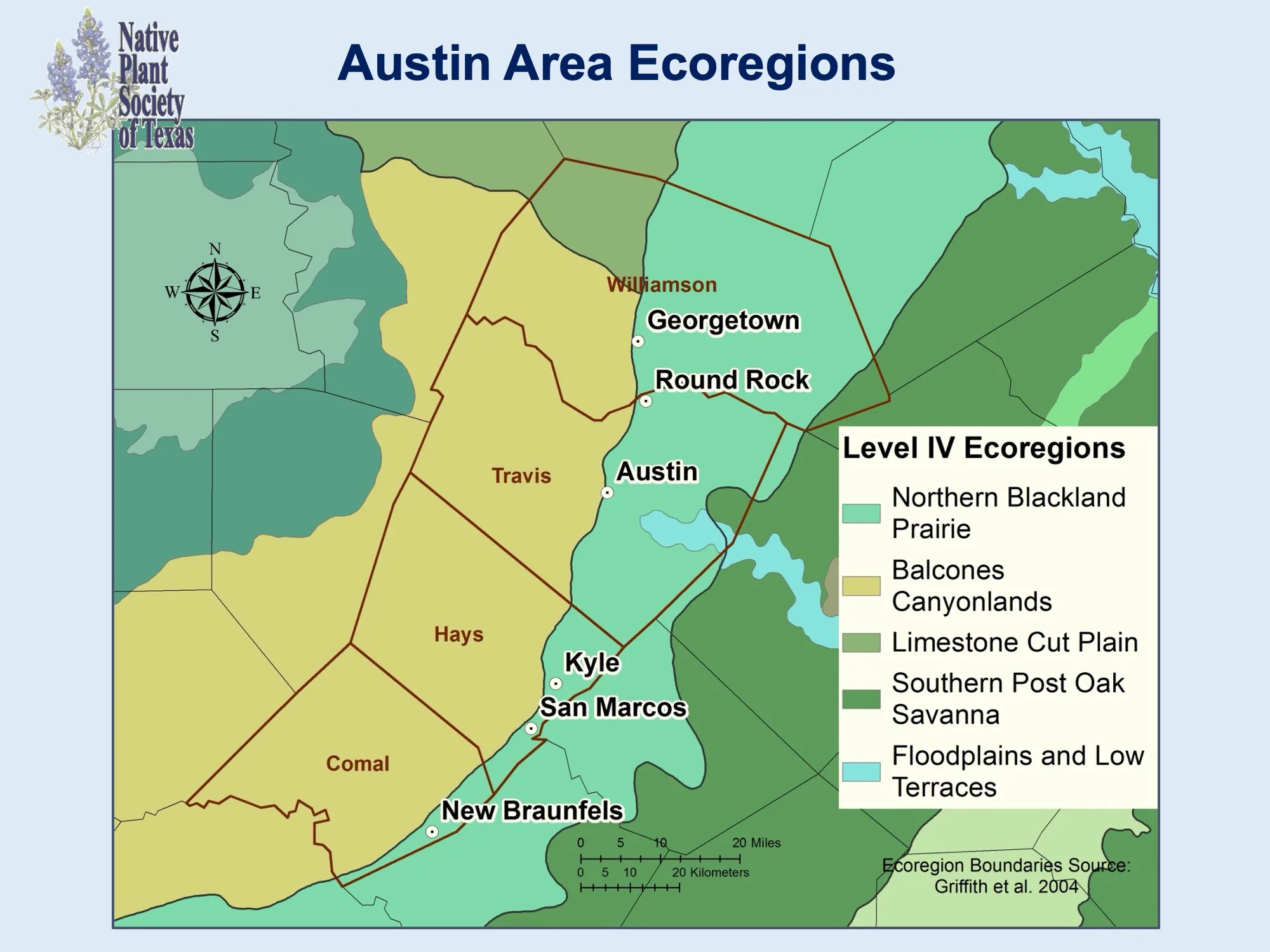 | Austin Area Plant List |
| Big Bend Area | 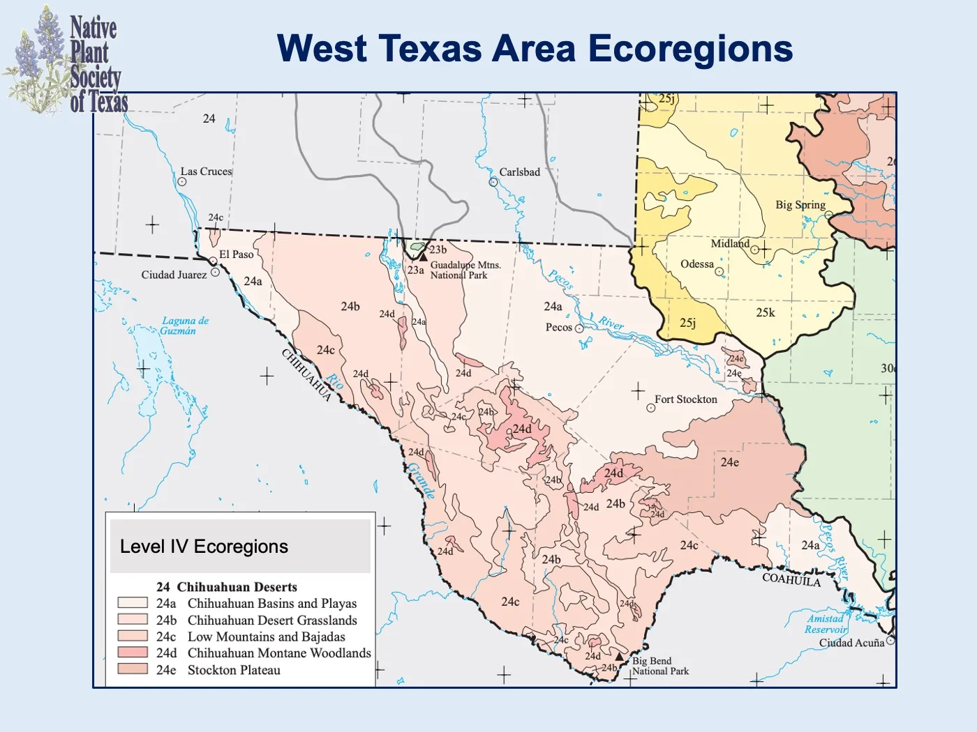 | Big Bend Gardeners Guide |
| Boerne Area | 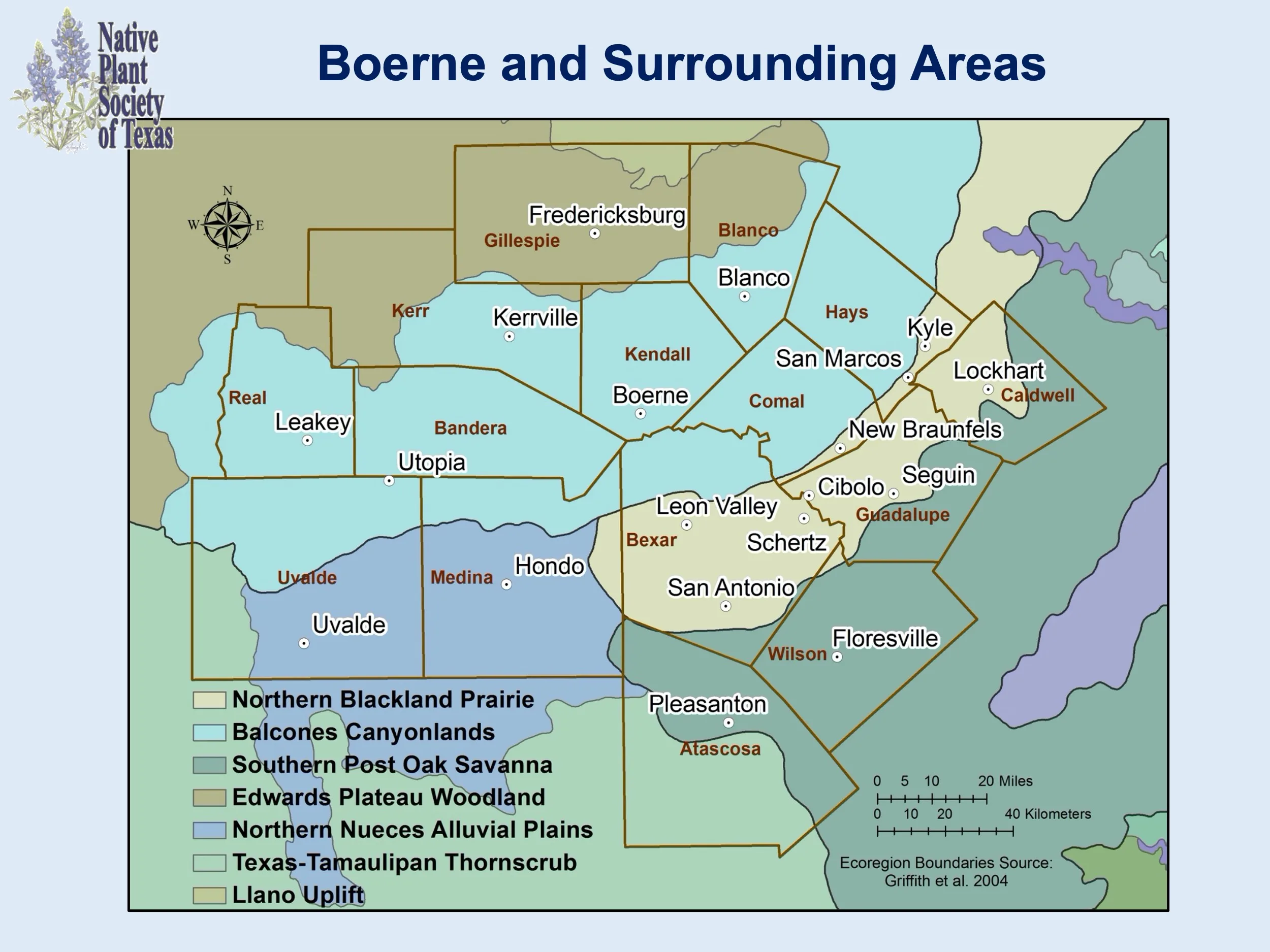 | Boerne Area Plant List |
| Corpus Christi Area | 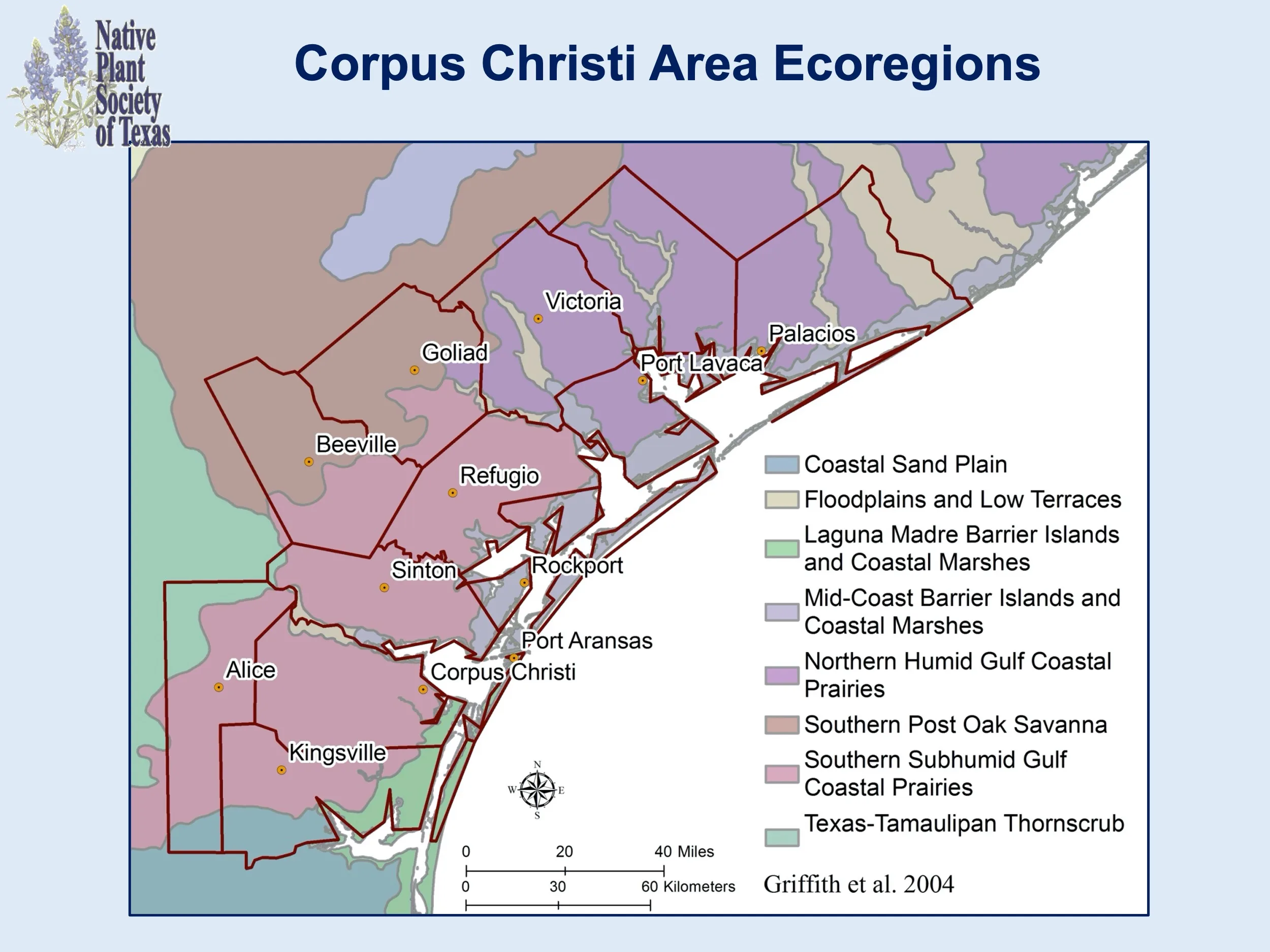 | South TX Area Area Plant List |
| Fredericksburg Area | 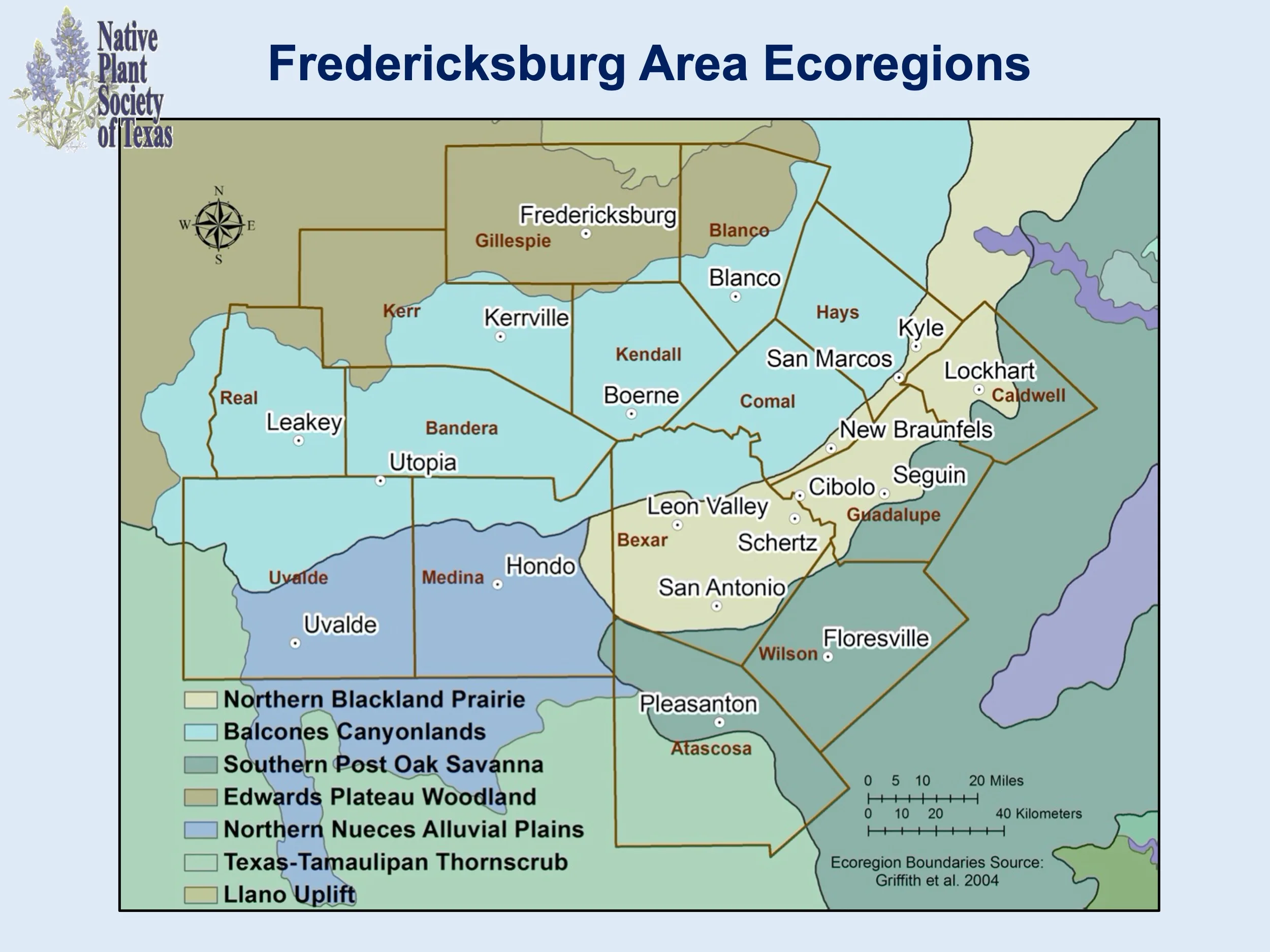 | Fredericksburg Area Plant List |
| Highland Lakes Area | 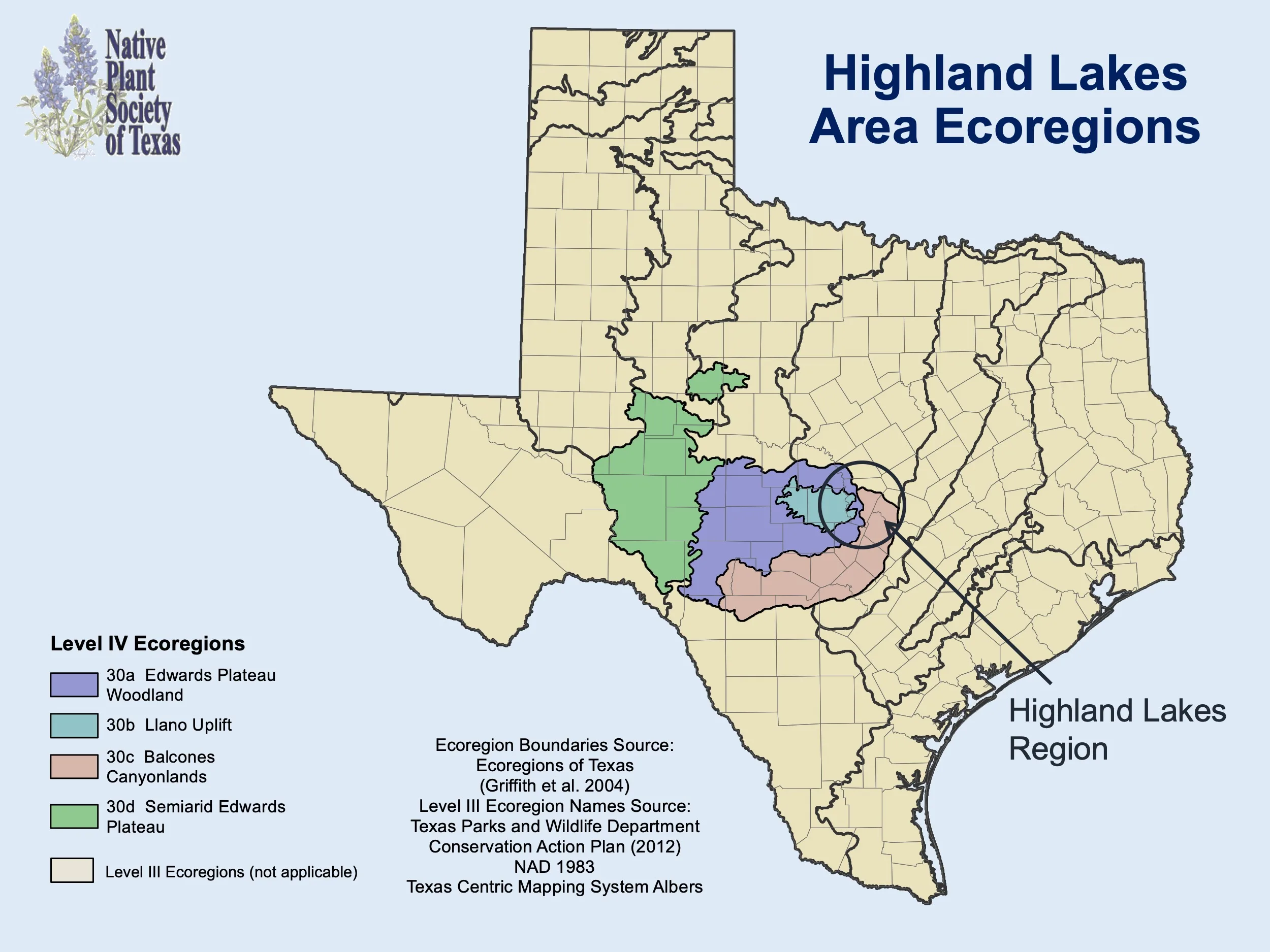 | Highland Lakes Area Plant List |
| Houston Area | 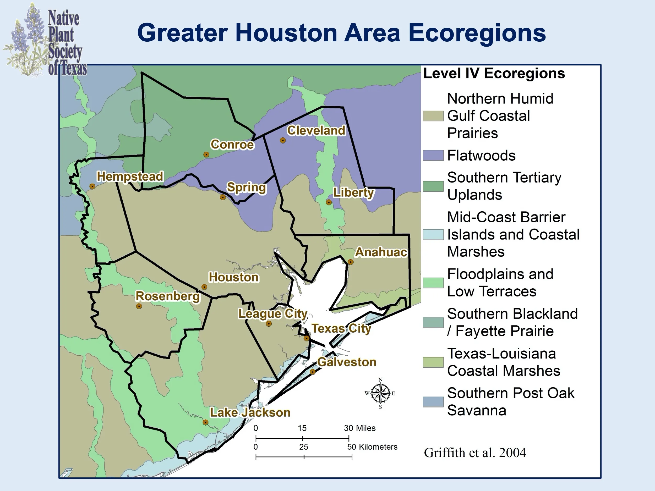 | Greater Houston Area Plant List |
| Kerrville Area | 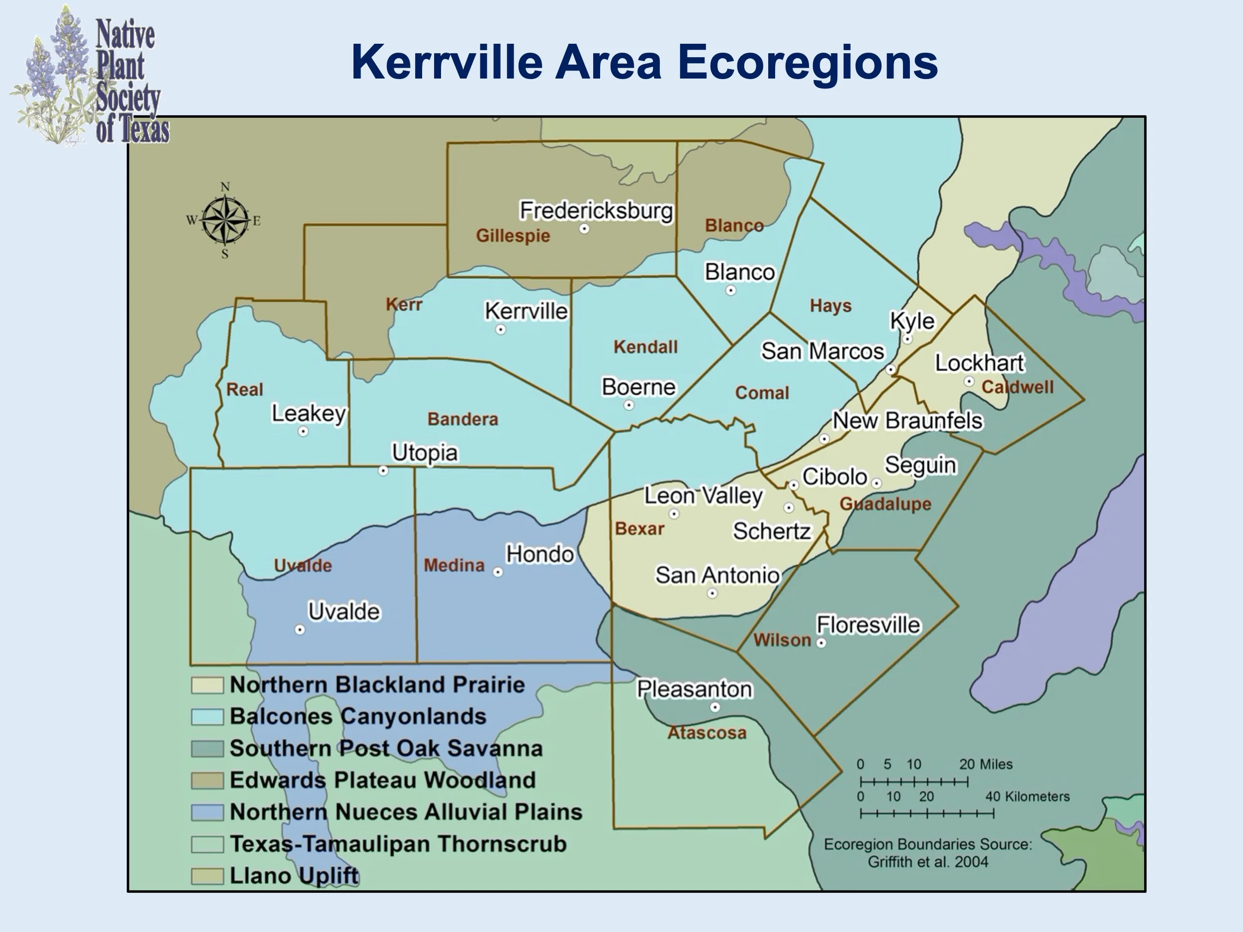 | Kerrville Area Plant List |
| Conroe Area (Montgomery County) | | Greater Houston Area Plant List |
| New Braunfels Area | 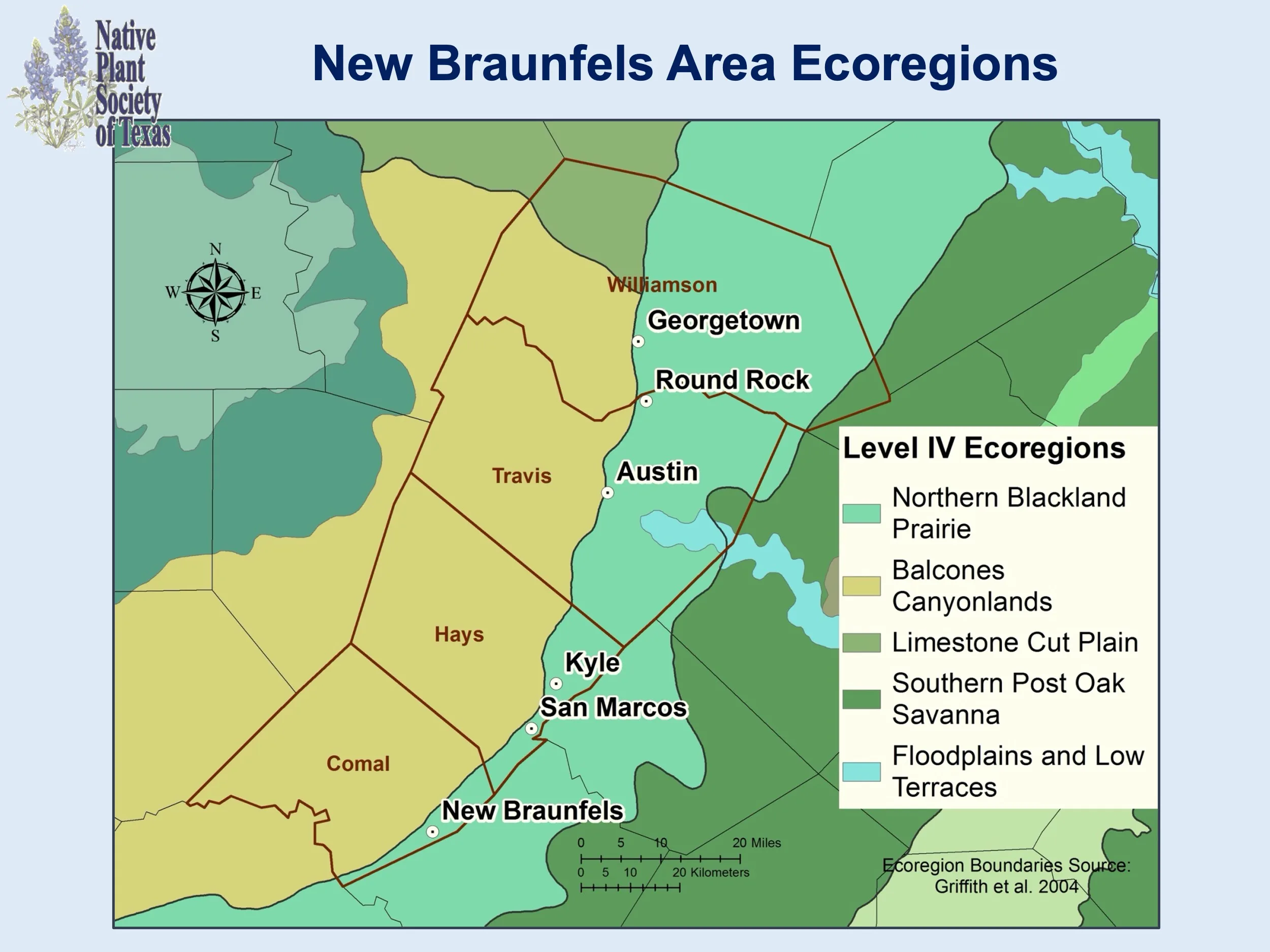 | New Braunfels Area Plant List |
| North Central Texas Area | 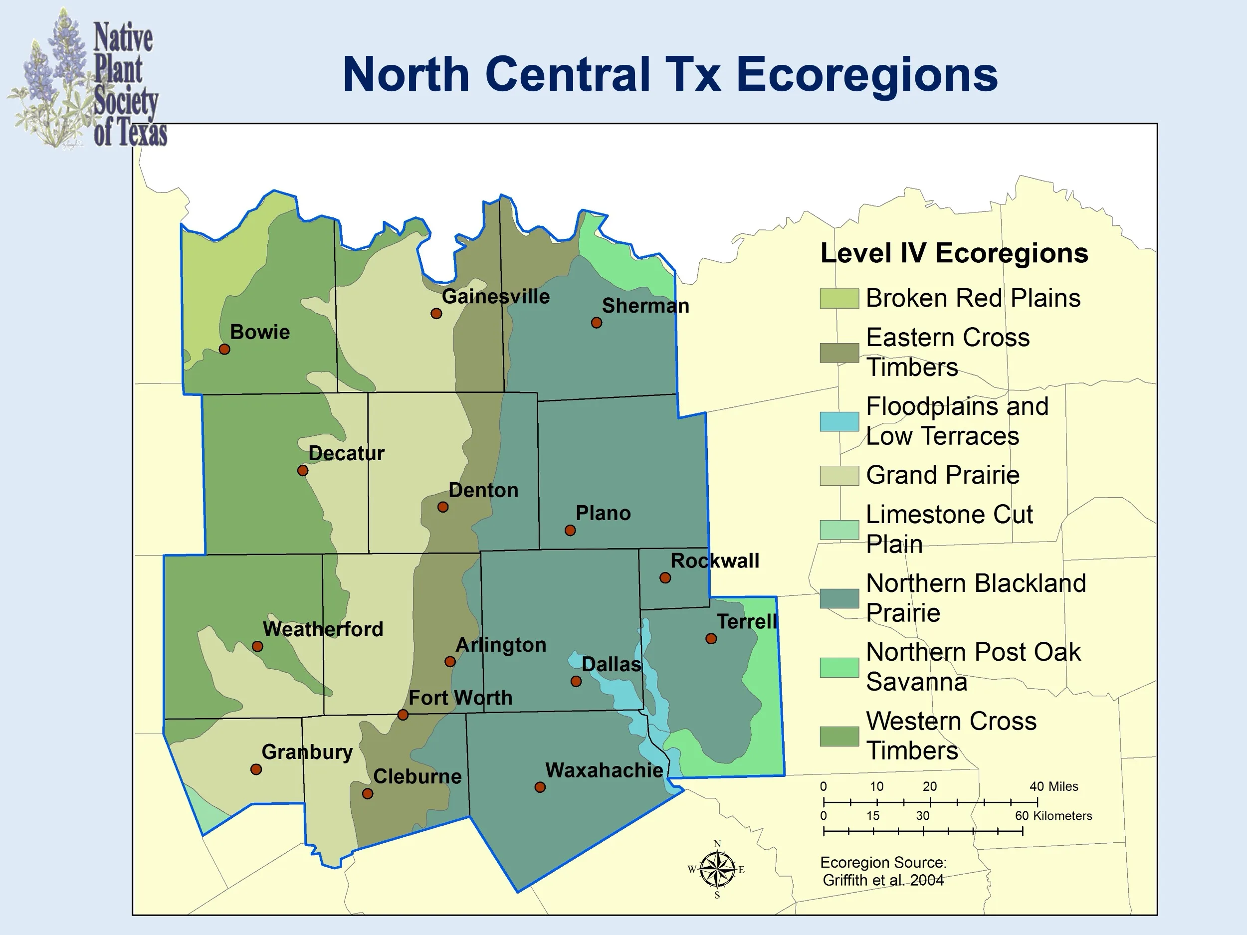 | North Central TX Area Plant List |
| Northeast Texas Area | 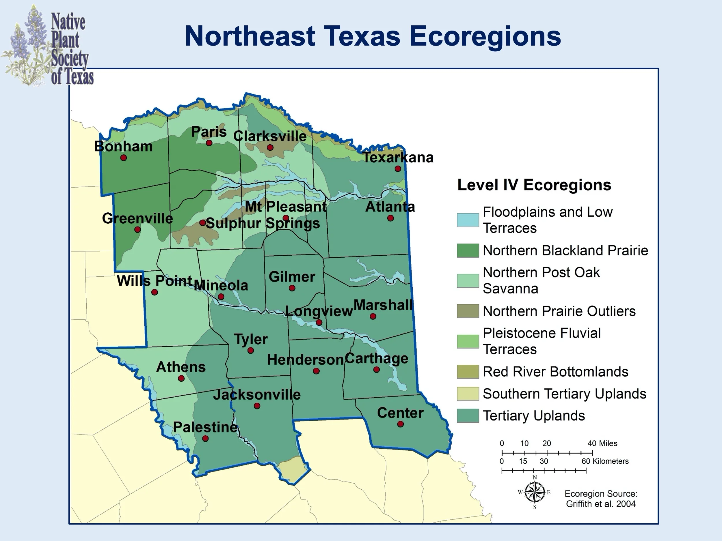 | Northeast TX Area Plant List |
| San Antonio Area | 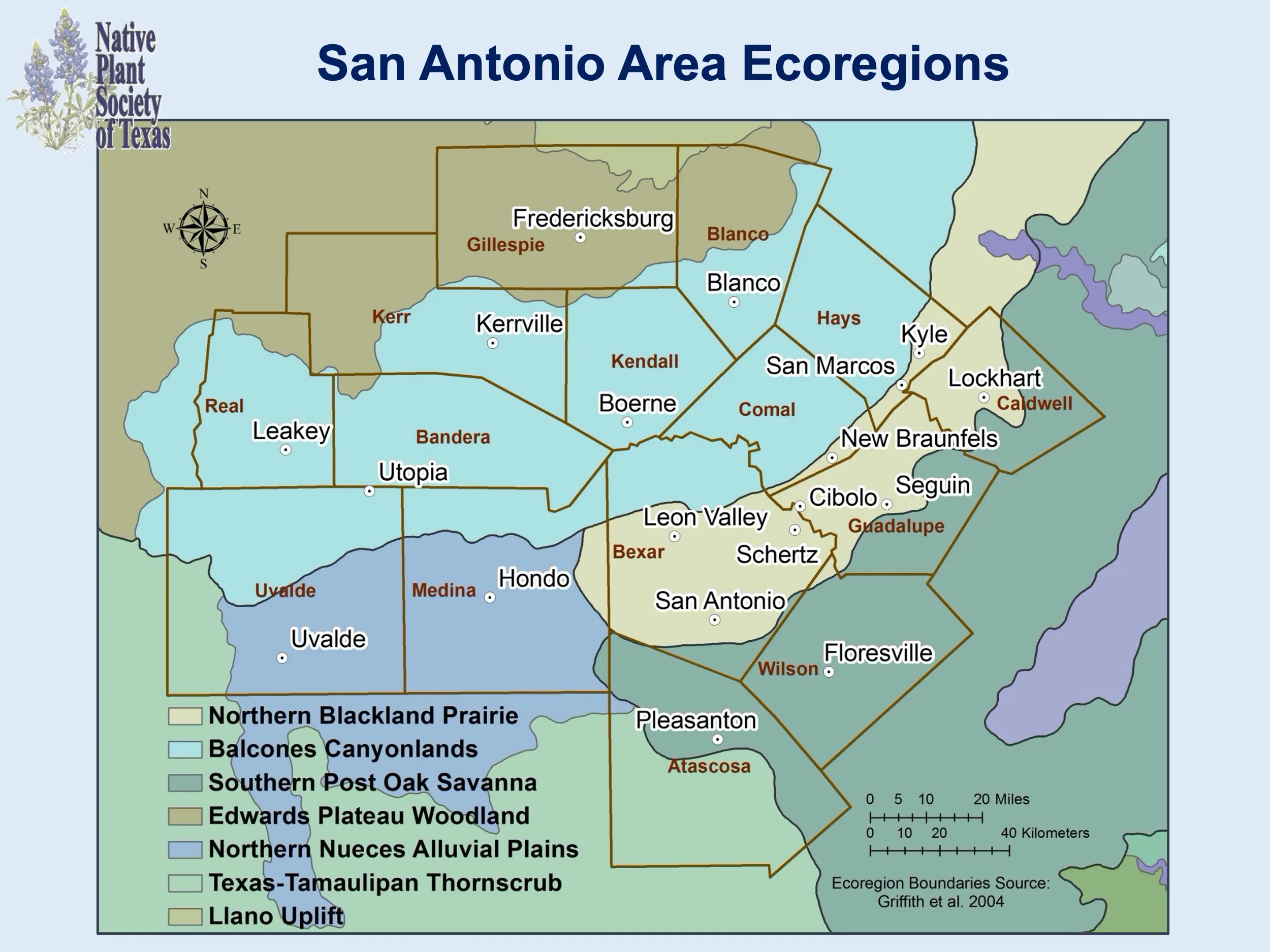 | San Antonio Area Plant List |
| Williamson County Area | 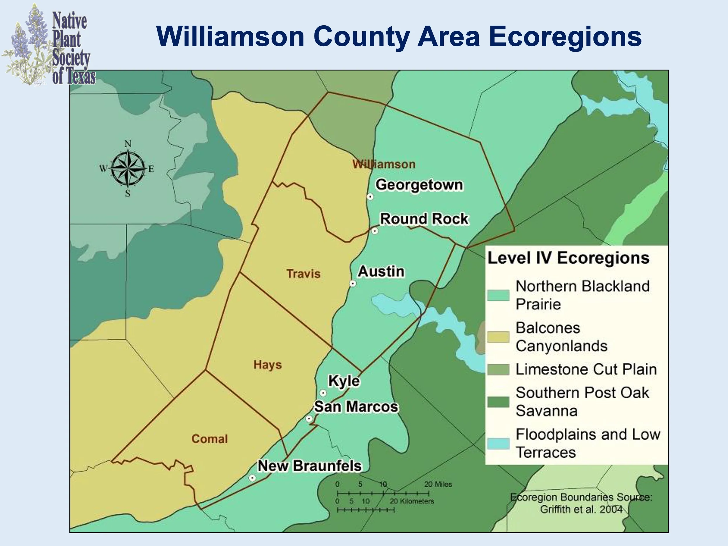 | Williamson County Area Plant List |