

“Sing me a melody – Sing me a blues
Walk through the bottomland without no shoes
The Brazos she’s running scared – She heard the news
Walk through the bottomland without no shoes”
Prairies are not our only ecosystem here in North Texas. Another vital ecosystem, albeit much smaller in scope, is Bottomland Hardwood Forests. In the U.S., they are one of our most widely distributed and biologically diverse ecosystems.
What is a Bottomland Hardwood Forest?

There are a variety of definitions of these forests, and the areas they encompass. A common definition states the following three characteristics:
- Periodically inundated or saturated by surface or groundwater during the growing season.
- Soil saturation occurs periodically within the root zone during the growing season.
- Common tree species in the area have morphological and/or physiological adaptions, which allow them to survive in an environment where the soils may be depleted of oxygen.
Bottomland forests are a transition area between more arid upland hardwood forests or prairies and very wet river floodplains and swamps. They can withstand some flooding but are unable to tolerate extended flooding like a swamp.
Benefits to our Environment
These are vital ecological areas offering many benefits, including flood and erosion control, wildlife and plant diversity, and groundwater recharge.
The Bottomland Hardwood Forest’s environmental benefits derive from its highly dynamic ecosystem due to adaptations developed over millennia. It is a delicate balance of water, soil, air, plants, and wildlife interacting through seasonal cycles. These fluctuations require adaptive plants and wildlife to thrive in sometimes challenging conditions.
However, its characteristics have also made it susceptible to logging, water control projects, agriculture, and land development.
Geographic Distribution
There are not only differences in its definition, but also in the range of the Bottomland Hardwood Forest. We will be focusing on the forests of the southeast U.S., which encompasses the eastern third of the state, including here in North Texas.
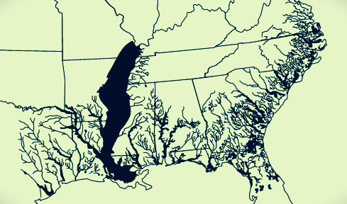
As shown nearby in the darkened areas of rivers, we occupy the farthest western reaches of this range due to the Trinity River and Red River basins. The aridness of areas to our west prevents further bottomland forests.
Topography of the Bottomland Hardwood Forest
A fascinating element of the Bottomland Hardwood Forests is the topography that developed over millennia. Changes in a river’s water level are responsible for the creation of these distinct zones. In some cases, the zones can be only a few feet apart, but the soil and water conditions can be vastly different, resulting in drastic vegetation change.
However, the arrival of European settlers brought water control projects that have disrupted these zones. As a result, flood control and reservoirs have greatly altered these zones and reduced the scope of most forests.
Below is a cross-section of the forest broken into typical zones and a brief description of each:
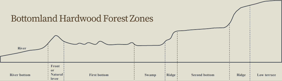
- River – Open water at all times of the year.
- Natural levee – High, well-drained ridges from repeated floods.
- First bottom – Recent or present floodplains which contain newer deposits of sediment.
- Swamp – Abandoned section of a river channel filled with sedimentation.
- Ridge – Banks of older, smaller, or less permanent watercourses.
- Second bottom – Remnants from former floodplains.
- Low terrace – The valleys of river systems and transition to uplands.
Native Plants of the Bottomland Hardwood Forests
The periodic flooding and resulting lack of oxygen in the soil prevent upland plants from establishing. But trees, woody vines, and other plants adapted to the soggy conditions can thrive. The native plants of the forest can be broken down by their vertical layers:
- Upper canopy of large dominant hardwood trees
- Under canopy of shorter trees and shrubs
- Near the forest floor, including native grasses, perennial forbs, and some annuals.
Below is a partial listing of common native trees and plants to North Central Texas’ Bottomland Hardwood Forests. We have listed just a few species. A more comprehensive listing is available from the Preservation Society for Spring Creek Forest in Garland (note: includes invasives species).
Trees and Shrubs
- Bur Oak (Quercus macrocarpa)Bottomland forests can differ widely in their primary hardwood trees, even within a narrow geographic range.
- Cedar Elm (Ulmus crassifolia)
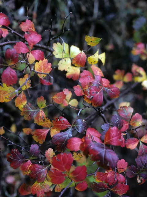
- Fragrant Sumac (Rhus trilobata)
- Green Ash (Fraxinus pennsylvanica)
- Red Mulberry (Morus rubra)
Woody Vines
The forests support a variety of woody vines that can occupy all three vertical layers as they climb high into trees.
- Virginia Creeper (Parthenocissus quinquefolia),
- Trumpet Creeper (Campsis radicans)
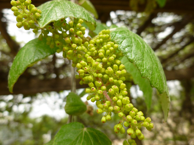
- Mustang Grape (Vitis mustangensis)
Grasses
Native grasses are infrequent in the forest due to the lack of light and abundance of moisture, features in which many grass species cannot thrive.
- Inland Sea Oats (Chasmanthium latifolium)
- Switchgrass (Panicum virgatum)
Forbs
Like native grasses, most forbs or wildflowers, are not tolerant of the conditions of the bottomland forest, making them relatively scarce.
- Pigeonberry (Rivina humilis)
- Frostweed (Verbesina virginica)
Location of Bottomland Hardwood Forests in North Texas
Finally, understanding these magnificent forests is best done in person. Below is a partial listing and map of forest remnants, both in near-virgin and lightly disturbed conditions, in and around Collin County:
- Great Trinity Forest (Dallas) – By far, our largest stand of Bottomland Hardwood Forests is within the Trinity River Corridor in southeast Dallas. It is one of the largest urban bottomland forests in the U.S., encompassing nearly 5,000 acres.
- Lewisville Lake Environmental Learning Area (LLELA) (Lewisville) – Much smaller in scope is an area within the LLELA that borders the Blackland Prairies to the east and Cross Timbers to the west. The forest is fed primarily by the Elm Fork of the Trinity River.
- Spring Creek Forest (Garland) – Highly diverse forest with over 650 species of plants and animals. Located within the flood plain of Spring Creek, it includes near-pristine sections of forests.
- Ray Roberts Greenbelt (Denton) – Remnant portions of bottomland forest exist in the Greenbelt south of the lake, fed from the Elm Fork of the Trinity River.
- Oak Point & Bob Woodruff Parks (Plano) – Small remnants of disturbed bottomland forests, fed by Rowlett Creek.